

The free mapping service by Google is getting an update to meet with the new normal. The tech giant will include colour-coding in their maps to indicate hotspots in the areas that have been infected by Covid-19 as reported by Astro Awani.
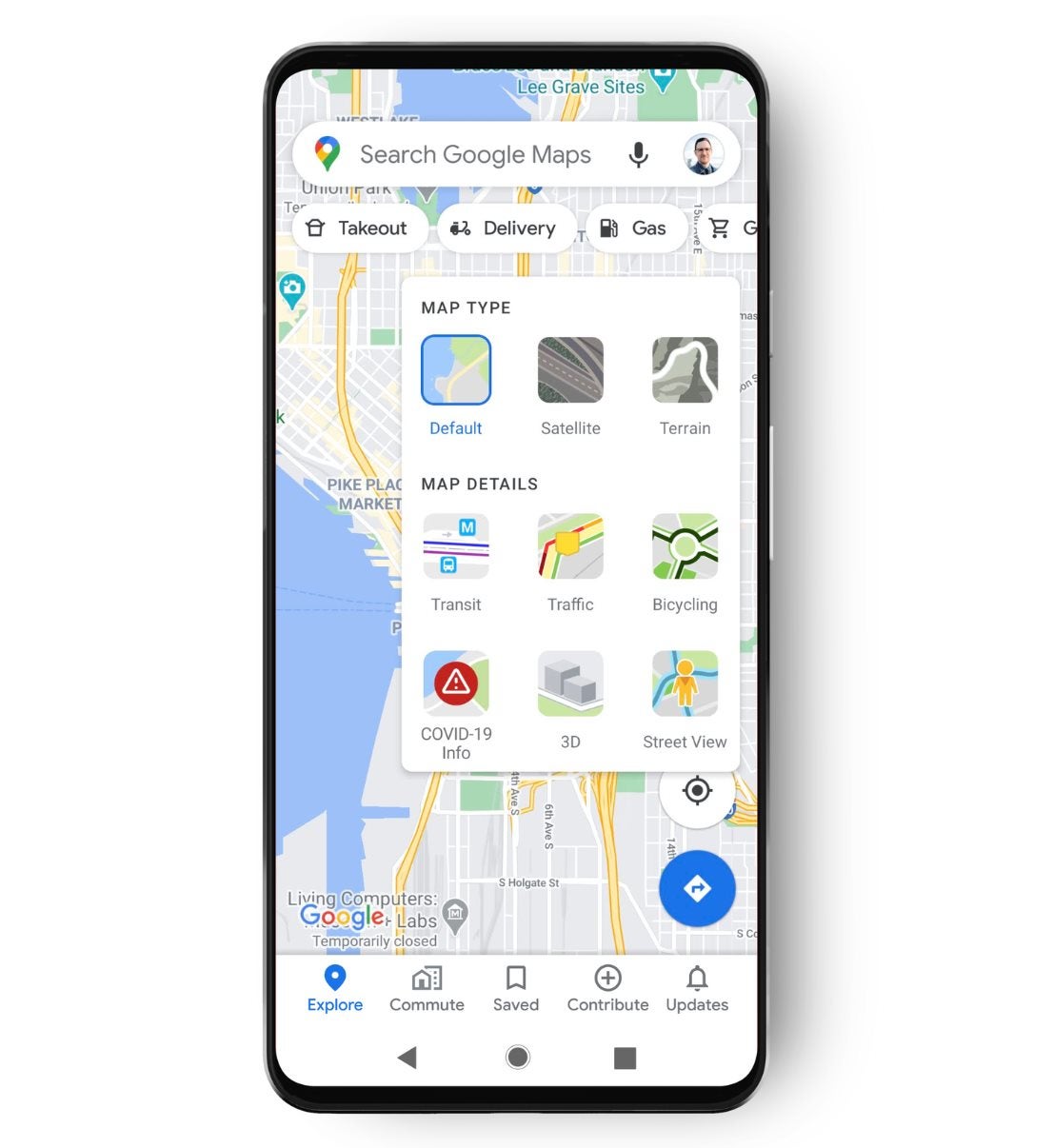
To activate the new Covid-19 feature, users would need to tap the layers at the top corner of the screen. The map will then show the latest 7-day average of cases per 100,000 people in areas being viewed.
There will also be a label to inform the users whether the number of Covid-19 cases in a particular area is trending up or down. According to the product manager of Maps, Sujoy Banerjee, the feature is added to provide critical information regarding Covid-19 cases in an area.
The Covid layer will help a lot of users to make the precise decision about where to go and what to do. The data used in the feature is sourced from multiple sources which include Wikipedia and the New York Times. These sources get their data from public health organizations such as the World Health Organization and government health ministries.
The feature will be released worldwide by this week. It will be available for versions of the map app made for mobile devices powered by Apple or Google-backed Android software.
Will you be using the Covid layer feature? Let us know in the comments.
Also read: Among Us 2 is Cancelled! Developers To Improve Original Game Instead of Releasing Sequel