
Yesterday (26 November), we reported on the Malaysian Meteorological Department’s (MET Malaysia) advisory regarding a tropical depression detected at a Latitude of 5.1° North and Longitude of 98.5° East. The closest position in Malaysia to the tropical depression was approximately 202km Southwest of Georgetown, Penang.
Now, MET Malaysia has updated the advisory, saying that a tropical storm named Senyar has been detected at 3.6°N, 99.9°E off northern Sumatra and about 102km southwest of Lumut.

For illustration purposes
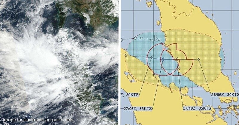
MET Malaysia issued an advisory on tropical storm Senyar moving into the Strait of Melaka
In a statement posted on its official Facebook page, MET Malaysia director general Dr Mohd Hisham Mohd Anip said the storm is moving east-southeast into the Strait of Melaka. Tropical Storm Senyar is currently heading west of Peninsular Malaysia at approximately 24km/h.
“This situation is likely to bring continuous heavy rain, strong winds and rough seas across Peninsular Malaysia, particularly in the western and central states, beginning 27 November,” the statement reads.
Continuous rainfall, strong winds and rough seas warning for several Malaysian states have been issued
Accordingly, the tropical storm warning has been updated with a continuous rainfall warning and strong winds and rough seas warning for Kedah, Penang, Perak, Pahang, Selangor, Kuala Lumpur, Putrajaya, Negeri Sembilan, Melaka and Johor, effective from today until Sunday (29 November).
MET Malaysia will continue to monitor the storm and provide updates based on the latest conditions.
The statement concludes with advice to the public to remain vigilant and follow forecasts and warnings via the MET Malaysia website, the myCuaca app, official social media and the hotline at 1-300-22-1638.
Also read: MET Malaysia Issues Advisory as Tropical Depression Detected Near Penang, Here’s What It Means